Other destinies await surface and groundwater too. The Great Basin, covering almost all of Nevada and portions of five other states, is an example of systems where water cycles entirely within the area where the precipitation falls (an endorheic system). The result on the surface is drainage to terminal lakes where evaporation and seepage into the bedrock are the only natural mechanisms for water loss. A final result for these systems, when evaporation exceeds precipitation, can be a salt flat, such as the famous Bonneville salt flats in Utah, or, Great Salt Lake, a modern remnant of ancient Lake Bonneville.
Intermediate results include lake basins such as Pyramid Lake, Nevada, where lake levels and salinity change on a decadal time scale as a function of short-term climatic variation, and, more recently, diversions for irrigation and hydroelectric generation. The indigenous Lahontan cutthroat trout, cui-ui, and tui chub are fishy features of special note that we will revisit at a later time.
 |
| Moderate flow, approx. 1 foot above summer level, transparency about 35 cm. in a turbidity tube |
The most conspicuous of these is the turbulent flow through hardwood forest and meadow, meandering as much as it can within the confines of the stream banks. Where flow is laterally constricted, as in passing between bridge abutments, some scouring will occur, re-suspending silt and sediments previously deposited, and moving them downstream to slower channels where the heavier particles will settle to the bottom again. Similar scouring of banks on the outer river bends , and deposition on the inner bends keeps the stream in a state of continuous lateral movement. Some of the very finest of suspended particles may remain in suspension over great distances, depending upon the velocity of stream flow.
At flow levels exceeding riverbank heights, some water escapes main channels, courses through meadows, drops sediment there. At high flood, riverbanks erode laterally, changing the channel cross-section, thus changing the location of maximum hydraulic pressure. Root balls or well-anchored riparian vegetation create further deflection of the thalweg, causing it to scour yet another path of least resistance. Thus does the river meander, never the same water, never the same path.
 |
| Streamside base spring on karst landscape in the Camp Creek valley |
 |
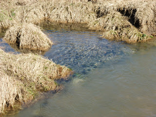
| Spring water flowing over gray cobble (left) and mixing with turbid stream water (right) |
What does all this mean for trout inhabiting these waters? The lower temperatures certainly keep their metabolism low and reduce both energy demands, and feeding rates. So too, do many stream invertebrates reduce their activity levels, the exceptions being those species that are especially adapted to colder temperatures. In these cases, the insects, themselves, take advantage of the torpor of the trout, emerging at a time when stream fishes and other predators may be least threatening to them. While cold-climate adaptations might reasonably be expected in polar or alpine environments, recent research is
beginning to show important adaptations in other latitudes too.
For all things, there is a season.
No comments:
Post a Comment